Every few years, the surface waters of the central and eastern tropical Pacific Ocean warm significantly above their normal levels. This shift triggers a cascade of atmospheric changes that reach far beyond the Pacific itself — altering rainfall patterns, fueling droughts, intensifying storms, and pushing global temperatures higher. The phenomenon is known as El Niño.
Origins and Mechanics
El Niño forms part of a larger climate cycle called the El Niño-Southern Oscillation, or ENSO. Under normal Pacific conditions, strong trade winds blow warm surface water westward toward Australia and Southeast Asia. During an El Niño event, those winds weaken. Warm water sloshes back toward South America, suppressing the upwelling of cold, nutrient-rich water along the western coasts of Peru and Ecuador.
The warmer ocean surface then transfers additional heat and moisture into the atmosphere above it, disrupting the jet streams and pressure systems that govern weather across multiple continents. The pattern typically develops between late Northern Hemisphere spring and summer, reaches its peak during December and January, and dissipates by the following spring — though duration and intensity vary from cycle to cycle.
Regional Impacts Across South America
For South America, El Niño carries consequences that differ sharply by region. Northern South America and the Amazon basin tend to experience drier-than-normal conditions, heightening wildfire risk and stressing agriculture. Meanwhile, the southern cone — particularly Argentina, Uruguay, and southern Brazil — often receives above-normal rainfall, which can lead to flooding and crop damage.
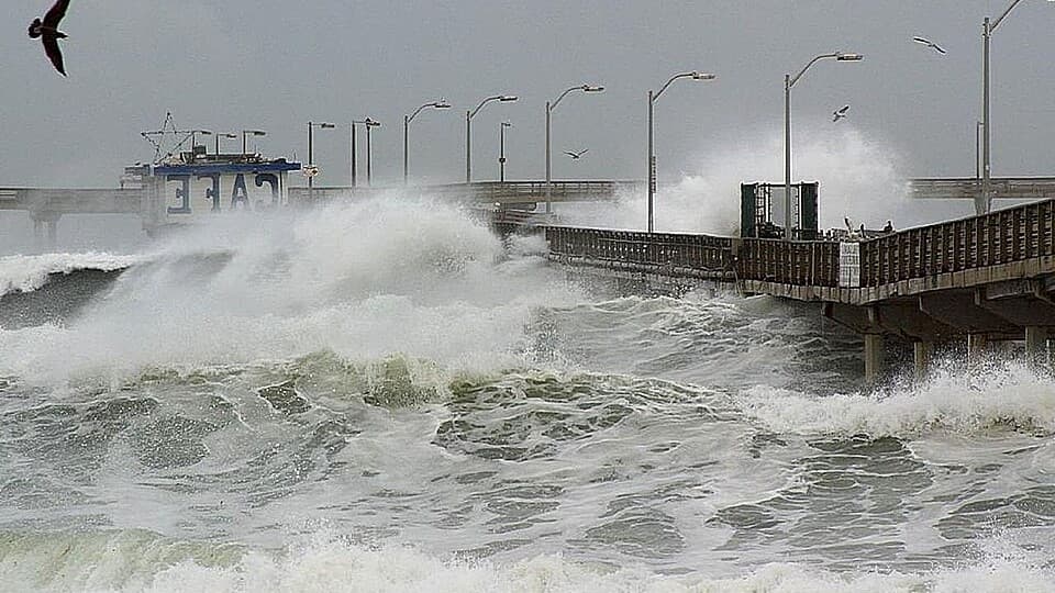
Peru and Ecuador sit directly in the path of warming coastal waters, historically suffering some of the most severe economic disruption. The collapse of anchovy fisheries, destruction of coastal infrastructure by powerful waves, and devastation of agricultural zones have repeatedly followed strong El Niño events in those countries.
The Link to Record Global Temperatures
El Niño does not create global warming, but it amplifies it. The additional heat released from the Pacific's warmer surface layers adds to the background warming already driven by rising concentrations of greenhouse gases in the atmosphere. The result is that El Niño years tend to rank among the warmest on record globally.
Climate scientists at agencies including NASA and the World Meteorological Organization have documented this pattern across multiple decades of temperature records. The years that have set or approached global temperature records have frequently coincided with moderate-to-strong El Niño events. When an El Niño emerges against an already warming baseline — as is the case in the current era of climate change — the combined effect pushes average temperatures higher than any previous cycle of similar strength would have produced.
Forecasting and Preparedness
Meteorological agencies monitor sea surface temperatures, wind patterns, and subsurface ocean heat through a network of buoys and satellites. When indicators point toward a developing El Niño, official forecasts are issued months in advance, giving governments and emergency services time to prepare.
Countries across South America have developed early warning systems and disaster preparedness frameworks specifically calibrated to ENSO cycles. Agricultural ministries adjust planting advisories, water authorities manage reservoir levels, and civil defense agencies preposition resources in flood-prone areas based on these forecasts.
Despite improved forecasting tools, the precise intensity and timing of any given El Niño remain difficult to predict with certainty. The interaction between a warming ocean, shifting atmospheric dynamics, and the broader backdrop of long-term climate change continues to challenge scientists and policymakers alike.
Open Questions
Will increasing baseline ocean temperatures caused by climate change make future El Niño events systematically stronger? Can current early warning infrastructure in lower-income Pacific-facing nations keep pace with more volatile ENSO cycles? How will the compounding effects of El Niño and sustained climate warming be reflected in insurance, agriculture, and water policy across South America?
Sources: World Meteorological Organization (WMO), NASA Earth Observatory, National Oceanic and Atmospheric Administration (NOAA) ENSO Blog, Intergovernmental Panel on Climate Change (IPCC) Assessment Reports.